|
Scenic USA - Utah Hites Crossing |

| Photos by Roger Gillette |
With nearly 300 sunny days each year, southern Utah offers its visitors blue skies and a dry desert climate, with mostly mild winters and dry summers. The landscape is not without water though as four major rivers slice up the terrain in the southeast. Drawing in whitewater enthusiasts and paddlers during May and June, the San Juan, Green River, San Rafael and Colorado rivers are some of the favorites out of at least three dozen runable rivers. Beginning in the adjacent state of Colorado, the Colorado River is the most famous as it carves its way through the whitewater enthusiasts and paddlers Grand Canyon. Countless tributaries, big and small, add to the flow of the Colorado throughout its 1450 mile journey.
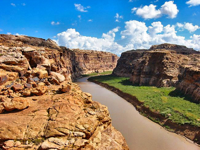
A moderate tributary, the Dirty Devil River joins the Colorado near Hites Crossing in Garfield County. Pictured here is the muddy Colorado as it flows through Narrow Canyon at Hite just downstream of the Dirty Devil. It's undecided whether to blame the mud-stained water on recent rain or the Dirty Devil itself. While the Dirty Devil contributes 150,000 tons of salt to the Colorado River each year, estimates suggest  the Colorado River moves 500,000 pounds of silt every day into Lake Powell. In the Grand Canyon and surrounding red rock country, it's the iron oxide in the Supai rock layer that stains cliff walls and gives the river its reddish hue.
A view from Hite Overlook, on top of a mesa, offers visitors a spectacular view of the Glen Canyon Recreation Area and Lake Powell. While the Glen Canyon Dam is still some 190 miles away from this overlook, sightseers get a good idea of the immense size of a sprawling Lake Powell, as well as a panoramic look at this endless countryside.
Area Map

|
More Area Attractions |
|
Copyright © 2024 Benjamin Prepelka
All Rights Reserved
