|
Scenic USA - Arizona Mogollon Rim |

| Photo by Clayton Esterson Clayton Esterson Photography |
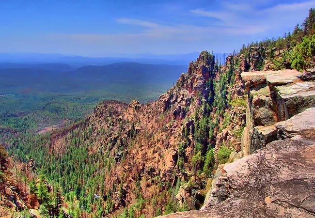
Arizona’s Mogollon Rim, a fine example of an extreme section of topography called an escarpment, stretches across the state for over 200 miles. Its dramatic cliffs, some rising 2000 feet, mark the southwestern edge of the Colorado Plateau. The Mogollon (MUGGY-own) Rim also draws a distinct border between one of the largest pine forests in the United States and a desert (one that may unjustly define Arizona).
The Rim Country is managed by four national forest service units, i.e., Kaibab, Coconino, Sitegreaves and Apache. Prized for its huge ponderosa pine forest, new ideas about fire suppression may have saved a half million acres consumed by fire. It’s now recognized that natural fires burn off accumulated undergrowth and debris without harming larger trees. Allowing years of decaying plant material to build creates conditions for much larger and hotter fires as witnessed in the Dude fire in 1990, and the Rodeo-Chediski fire in 2002.
Here along Rim Road (FR 300), sightseers will experience Zane Grey’s signature cowboy country. Spectacular rock outcroppings of sedimentary limestone and sandstone poke out from the thick pine forests. Mogollon’s plunging side canyons, magnificent forests and small towns dot the Rim, making an obvious sightseer's paradise. A cool respite from the desert heat, The Rim also offers a historic hiking system, horseback trails, picturesque lakes and plenty of outdoor elbow room.
Area Map

|
Additional Area Attractions |
|
Copyright © 2021 Benjamin Prepelka
All Rights Reserved
