|
Scenic USA - Maryland Mason Dixon Byway |

| Photos by Ben Prepelka Ben Prepelka Photography |
Settling a dispute between the Penn family and Maryland's Calverts, Jeremiah Dixon and Charles Mason spent five years mapping out Maryland's border with Pennsylvania and Delaware in the mid 1760s.  Calculating a straight line through this rugged country proved the tenacity of these young surveyors. Marked with 500 pound limestone posts at one mile intervals, today's modern measuring techniques applaud the accuracy of the Mason-Dixon-Line.
Following the Mason Dixon Scenic Byway not only gives travelers the sense of Mason and Dixon's pathway, but also offers a great way to explore northern Marylandís scenic countryside and rich cultural heritage.
Beginning at Emmitsburg, the 140 mile byway begins at the Mason and Dixon Discovery Center. Armed with a good idea of all the highways and towns included on the tour, byway visitors take off on an eastern heading to the Carroll County Farm Museum. A short side trip to the Union Mills Homestead and Grist Mill proves an interesting stop as they celebrate centuries of rural life. Moving further to the east, the Prettyboy Reservoir offers hiking trails, picnicking, scenic overlooks and some of the best mid-Atlantic brown trout fishing. At White Hall, the Northern Central Railroad Trail  offers a few ways to stretch your legs. Popular with bikers, joggers and horseback riders, the 10 foot wide trail allows a wide berth for everyone.
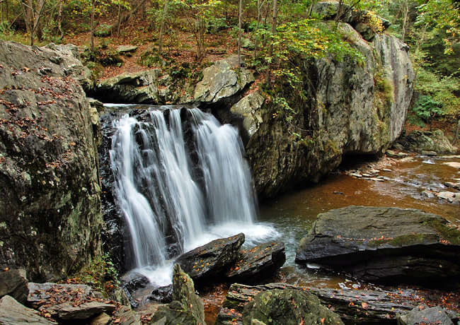
Another great place to take a break from driving, the Deer Creek Loop accesses the Eden Mill Nature Center, the beautiful Kilgore Falls site and Rocks State Park. Although it's no match for Marylandís tallest waterfall (Cunningham Falls), the secluded Kilgore Falls (main photo) creates a nice little backwoods adventure, fording a stream and exploring a nature walk.
Just beyond Darlington, byway travelers will pass over one of the nation's largest hydroelectric generating stations at Conowingo Dam. Here the Susquehanna River pauses to provide the area with electricity. The byway ends at the Fair Hill Natural Resource Management Area. Covered bridge fans will also enjoy the Fox Catcher Farm Covered Bridge here at Fair Hill.
Byway Route Map

|
Additional Byway Points of Interest |
Scenic USA Prints from
|
Copyright © 2020 Benjamin Prepelka
All Rights Reserved

