|
Scenic USA - Idaho Payette River Scenic Byway |

| Photos by Ben Prepelka Ben Prepelka Photography |
Following the narrow Payette River Valley, Idaho’s Route 55 connects towns of McCall and Eagle. Just north of Boise, Bogus Basin signals the beginning of the 112 mile Payette River Scenic Byway. The scenic byway connects a series of small resort towns, separated with long stretches of pure and wild Idaho landscape. Winding through forestland and passing towering mountains, recreation lakes and deep river valleys, the byway offers access to a mild or wild Payette River. Also, there is a string of national forest campsites and promising fishing holes. A section of the North Fork of the Payette is particularly noted for 15 miles of Class V rapids, the type of wild stuff that bears a warning label.
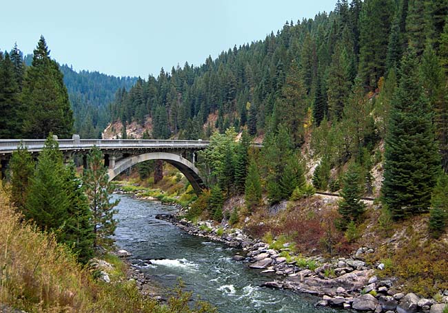
One notable structure you won't miss (pictured here) as you head northward, the largest single span arch bridge in the state. Added to the National Register of Historic Places, the Rainbow Bridge is recognized for its engineering design. The 410 foot span shows a 1933 effort to blend together the bridge and surrounding landscape.
When winter delivers a fresh layer of snow, this area takes on an even greater majestic appearance. Resort towns and ski areas gear up in the fall for skiers, snowmobilers, and snowboarders. Hundreds of miles of groomed snowmobile trails and miles of cross-country ski tracks make this an all-season wonderland.
Byway Map

|
Byway Attractions |
Scenic USA Prints from
|
Copyright © 2023 Benjamin Prepelka
All Rights Reserved

