|
Scenic USA - Kansas Smoky Valley Scenic Byway |

| Photos by Ben Prepelka Ben Prepelka Photography |
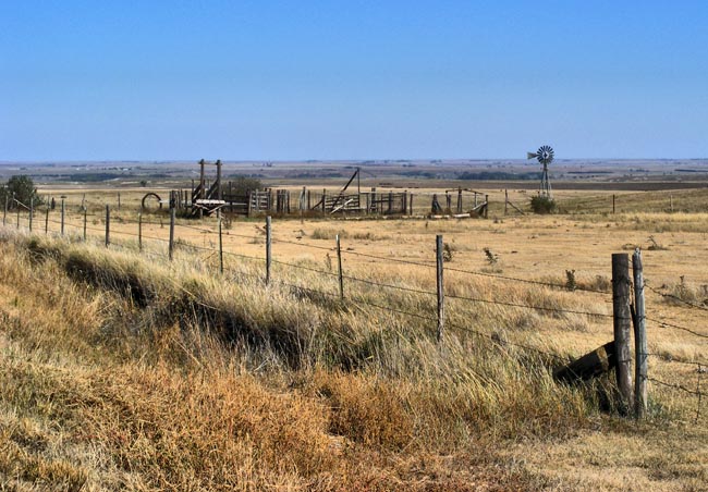
Heading south from WaKeeney and I-70 on the Midwest prairie, U.S. Route 283 appears on a map to be drawn with a straightedge. What's missing  from this two-dimensional view are all the undulating highs and lows of the Kansas hills. The Smoky Valley Scenic Byway leads visitors through the Smoky Hill River Valley and a mixed grass prairie. The byway surroundings change with the seasons, sprinkled with native wildflowers in the spring, bright fields of sunflowers in the summer, the deep reddish-browns of the milo seed pods (sorghum) during the fall, and the vivid greens of winter wheat.
 The 60 mile stretch, coupled with miles of secondary roads, offers broad views of the famed Smoky Valley (named for its hazy horizon during sunup and sundown), miles of ranches and farmland, prairie skyscrapers, and a large collection of the Midwest landmarks, the prairie windmill.
The Cedar Bluff Dam and Reservoir, owing all to the Smoky Hill River, may be the biggest surprise in the area. The large reservoir, in the midst of a semi arid prairie, is the place for water recreation and outdoor fun. The 100 foot high limestone bluffs, giving the Cedar Bluff State Park its name, dominate the south side of the lake and create a welcoming water retreat for all to enjoy.
Area Map

|
Additional Points of Interest |
Scenic USA Prints from
|
Copyright © 2020 Benjamin Prepelka
All Rights Reserved

