|
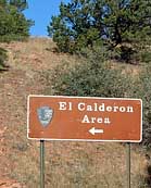
Scenic USA - New Mexico El Calderon Area |

| Photos by Ben Prepelka Ben Prepelka Photography |
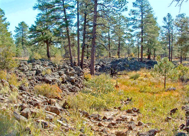
A closer look at this semi-arid desert grassland and  pine landscape reveals various undisturbed areas called kipukas. Escaping surface vocanism, the kipukas of El Malpais (el-mal-pie-EES) are surrounded with black and red lava, spatter cones, lava tubes and mysterious ice caves. Lava types, bearing the Hawaiian names of pahoehoe (pah-HOY-hoy) and a'a (AH-ah), are found throughout the El Calderon region of El Malpais National Monument. This mile high area lies adjacent to New Mexico Route 53, paralleling the Continental Divide National Scenic Trail. Here, and throughout New Mexico, volcanic events helped shape the earth. Eruptions began in El Malpais about 115,000 years ago and volcanic activity continued to surface in eight to ten thousand year intervals.
Well hidden among the New Mexico badlands (El Malpais), lava trenches and lava tubes extend for miles. Despite high temperatures during summer months, ice caves retain their ice throughout the year. During winter and spring, seasonal columns of  ice may grow to several feet high near the center of the cave.
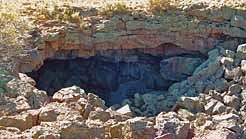
Offering an opportunity for exploration and a cool geology lesson, one of the easiest caves to reach is Junction Cave. A short hike from the parking lot reveals a cave that extends for a 1000 feet and drops 80 feet below the surface. The lava tube may be home to mice and squirrel near the entrance, and bats hang from the ceiling further down in the cave. Beyond Junction Cave, just off Route 53, the wilderness road turns primitive, accessible by high clearance vehicles, mountain bikes and by foot. A fairly easy three mile hike, visitors will find several landmarks on the loop trail, labeled Double Sinks, Bat Cave, Lava Trench and the El Calderon cinder cone.
A Cautionary Note from the National Park Service: Caving and hiking in remote areas are inherently dangerous. Loose footing, difficult terrain, disorientation, extreme heat and cold, and falls are common risks. Cave ceilings can be low and cause serious head injury. The monument is also home for poisonous scorpions and rattlesnakes, cactus spines and sharp yucca leaves. Check at the ranger station for a caving permit and information.
Park Map

|
More Area Attractions |
Scenic USA Prints from
|
Copyright © 2024 Benjamin Prepelka
All Rights Reserved

